
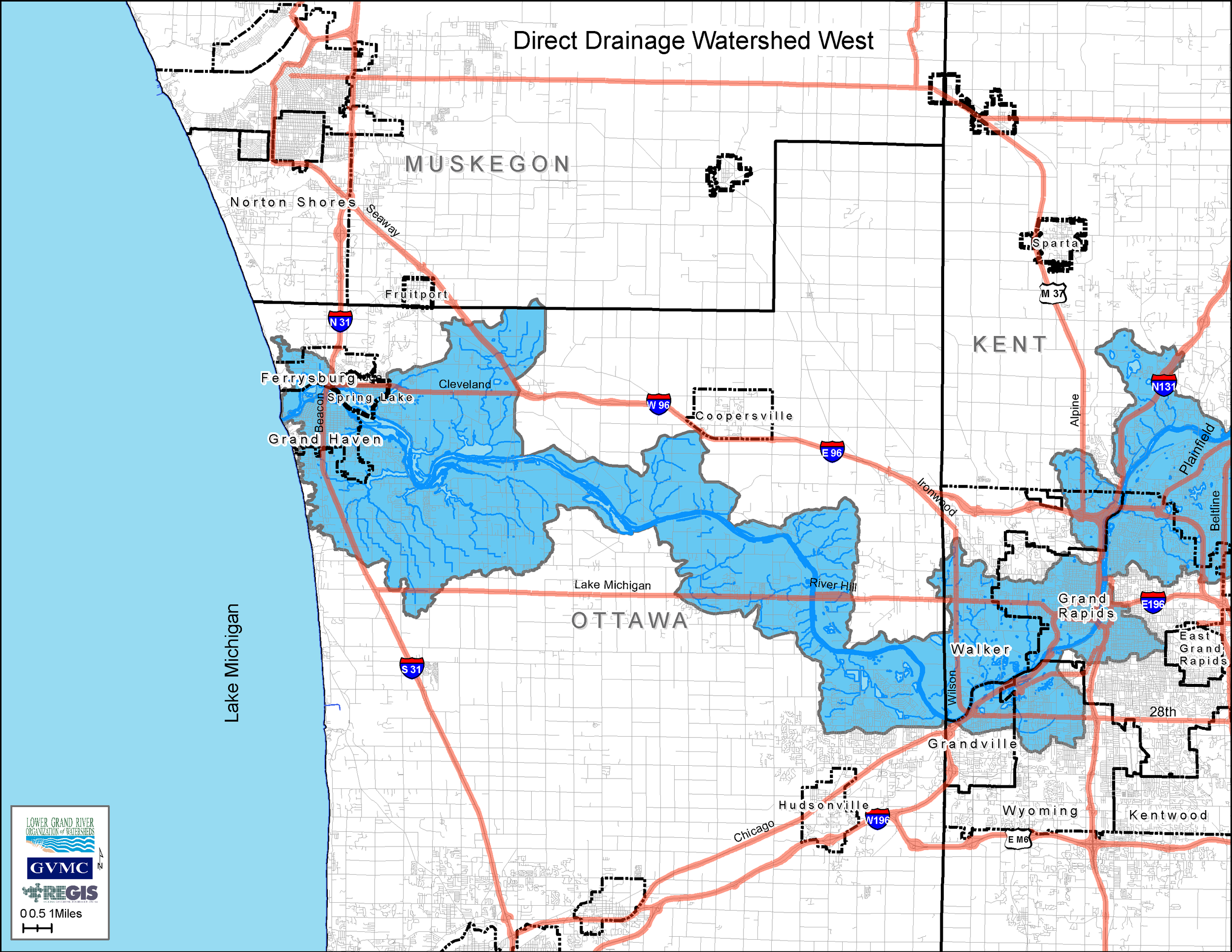
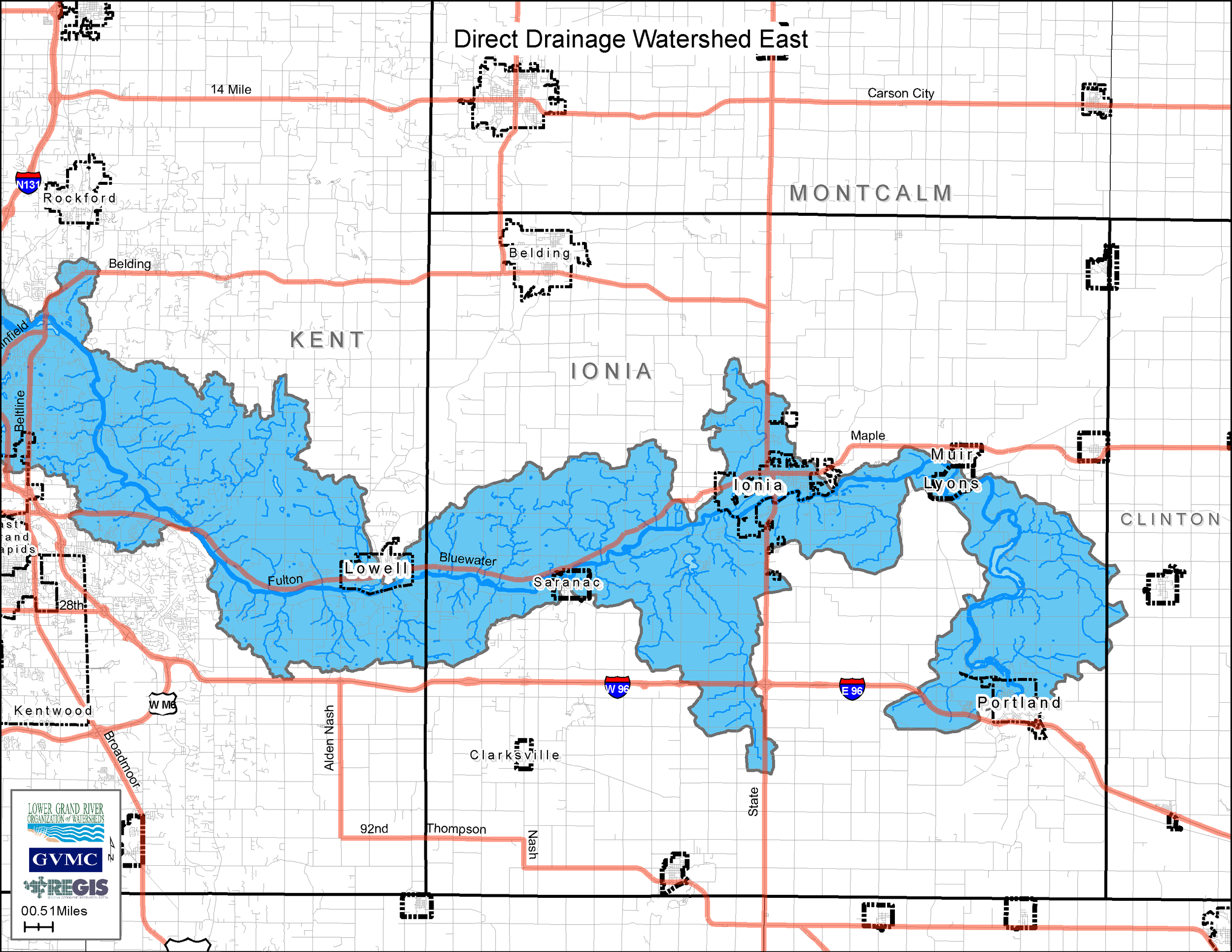
Direct Drainage to the Grand River – HUC Code: 04050006-0307, -0308, -0310, -0312, -0313, -0502, -0507, -0512, -0705, -0708, - 0709, -0712, 04050004-0710
Size and Location The Lower Grand River area covers 275,237 acres and runs through Ottawa, Kent, Ionia, and Eaton Counties. Direct Drainage to the Lower Grand River can be found in the cities, townships and villages of Ferrysburg, Spring Lake, Grand Haven, Grandville, Walker, Grand Rapids, East Grand Rapids, Lowell, Saranac, Ionia, Lyons, Muir, Portland, Crockery, Robinson, Allendale, Polkton, Tallmadge, Georgetown, Wyoming, Kentwood, Plainfield, Alpine, Cannon, Ada, Vergennes, Cascade, Boston, Keene, Eaton, Berlin, and Orange. According to the Lower Grand River Watershed Management Plant land use within the watershed is 33% agricultural, 26% forest land, 24% urban, 9% wetlands, 4% lakes, and 4% open land. This watershed is considered to be a high priority area for restoration and medium priority for preservation.
Priority pollutants in the Direct Drainage watershed are pathogens due to over or improper application of manure on cropland, uncontrolled livestock access to waterway, and aging septic systems. There are 72.8 miles of trout stream throughout in tributaries of Pottawatomie Bayou, tributaries of Millhouse, Stearns, Lloyd, Dermo, and Bruce Bayous, Unnamed tributary of Grand River, Goose Creek and unnamed tributary, Tibbets Creek, Unnamed tributaries of Grand River, Timberlin Creek, Crooked Creek, Toles Creek, Lee Creek, Unnamed tributaries to Grand River, Honey Creek and unnamed tributary to Honey Creek, Sunny Creek, Egypt Creek, Unnamed tributary to Egypt Creek,York Creek, Lamberton Creek, Unnamed tributary, and Roy's Creek.
Read the subwatershed summary here.

